Last Updated on: 13th December 2023, 05:09 pm
After several days of research and about six months of preparations, end of April – beginning of May I embarked on a journey to do the Everest Base Camp Trek.
Rewarding. Challenging. Life changing.
I enjoy hiking and I do it whenever I get a chance. This time was different, though. First of all, it was my first mountain hike in a foreign country. Secondly, I was going to reach altitudes never experienced before.
The highest peak in Romania, Moldoveanu, is only 2455 meters high. Lukla, the starting point of the Everest Base Camp trek sits at 2869 meters. Cho La Pass, the highest point of the trek, sits at 5,420 meters (17,782 ft) above sea level.
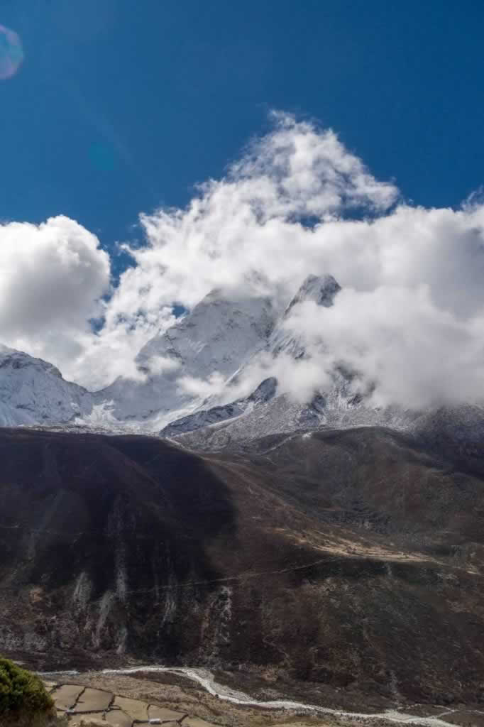
If you plan to do the long Everest Base Camp trek route which includes also crossing the Cho La Pass and Gokyo, you’d better assign a minimum of 20 days between your arrival to Kathmandu and your departure back home. The actual trek takes 16 days (Kathmandu to Kathmandu), but a time buffer could come in handy, should anything happen along the way.
Main Topics of Everest Base Camp Trek April – May
- Everest Base Camp Trek Day by Day Outline
- Quick Overview:
- Day 0: Unexpected One-Night Stopover in Istanbul
- Day 1: Arrival to Kathmandu
- Day 2: Kathmandu
- Day 3: Kathmandu to Lukla to Phakding
- Day 4: Phakding to Namche Bazaar
- Day 5: Namche Bazaar Acclimatization Day
- Day 6: Namche Bazaar to Tengboche (Tyangboche)
- Day 7: Tengboche to Dingboche
- Day 8: Dingboche Acclimatization Day
- Day 9: Dingboche to Lobuche
- Day 10: Lobuche to Gorakshep to Everest Base Camp and Back to Gorakshep
- Day 11: Gorakshep to Kalapatthar to Lobuche
- Day 12: Lobuche to Dzongla
- Day 13: Dzongla to Cho La Pass to Dragnag (Dragnak, Thagnak, Thragnak)
- Day 14: Dragnag to Gokyo Lake
- Day 15: Gokyo Lake to Gokyo Ri to Dole
- Day 16: Dole to Namche Bazaar
- Day 17: Namche Bazaar to Lukla
- Day 18: Lukla – We couldn’t change the date of our flight out
- Day 19: Lukla to Kathmandu
- Day 20: Kathmandu
- Day 21: Flight back home
Everest Base Camp Trek Day by Day Outline
This is my 2022 Everest Base Camp trip, as it unfolded, with facts, figures and personal recommendations.
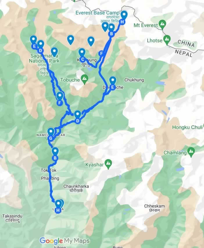
Click here to see the Everest Base Camp trek itinerary on the map. Please note that drawing the segment between Chola Pass and Gokyo wasn’t possible (there’s no representation of it on the map, but you’ll see it in the point-by-point itinerary).
Quick Overview:
- Start: Bucharest, April 28th 2022
- End: Bucharest, May 21st (the initial planning had May 18th as return date, but flights got messed up by the airline, so we changed it to ensure we’d be able to complete the hike)
- Total Trip Duration: 23 days
- Actual Trekking Duration: 16 days
- Total trekking distance: ~ 125 km
- Total walking time: ~ 90 h
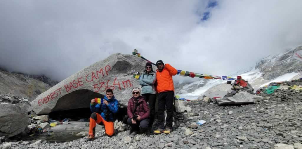
May 9th, 2022, 2:30pm (+ 30 min of waiting in line to take the shot) – Mission Accomplished – Our traditional Everest Base Camp photo
Day 0: Unexpected One-Night Stopover in Istanbul
We were supposed to fly directly from Bucharest to Kathmandu, with a short layover in Istanbul. Our second leg of the flight got canceled on a very short notice, so what was supposed to be a crazy run to catch the connecting flight in the Istanbul International Airport turned into a full day to spend in Istanbul, in a limbo where we had already left home but haven’t reached our destination.
Turkish Airlines created this problem, but they also provided the solution; they took care of all arrangements, they put us in a hotel midway between the airport and the city center, and they took us back to the airport the next evening.
It felt as if the planet stopped turning for one day, giving us the gift of a lovely stroll in Istanbul.
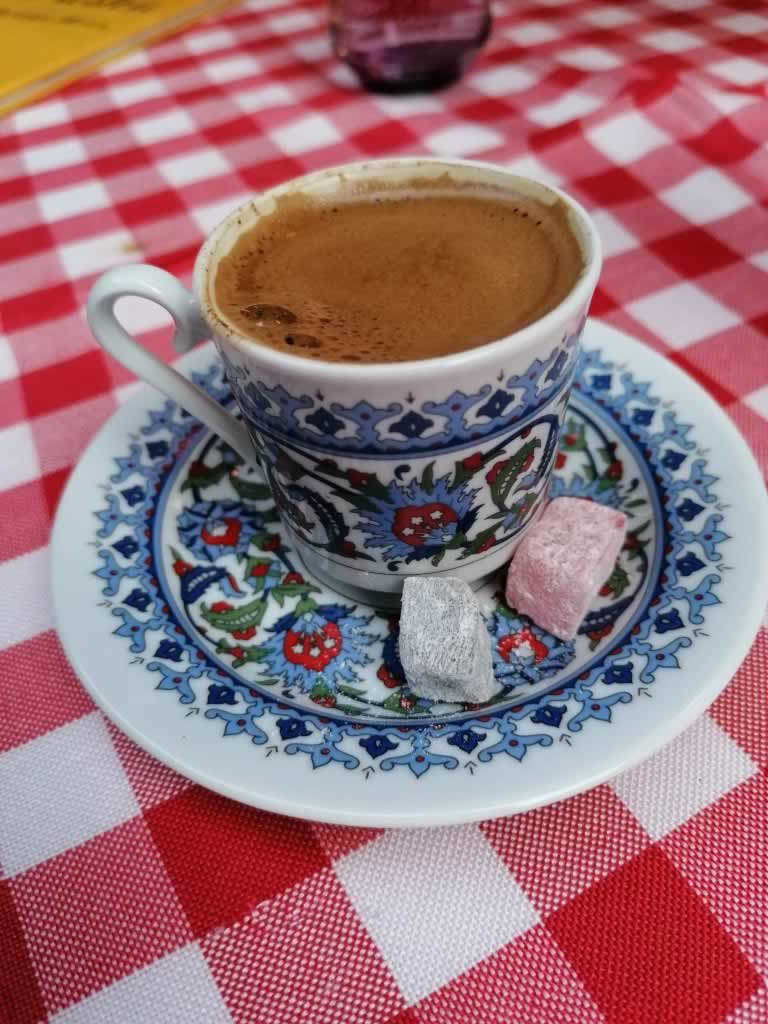
Genuine Turkish coffee comes with two pieces of Turkish Delight – Only in Istanbul
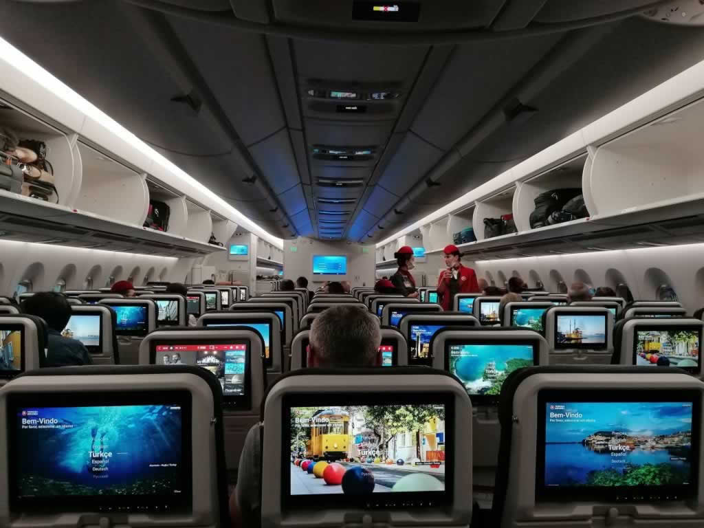
Turkish Airlines aircraft on the Istanbul – Kathmandu route
While everything went on smoothly and we had a great time in the city, things could have easily taken a wrong turn. We were fortunate that we didn’t need a visa or a negative PCR test to enter Turkey. Otherwise, we would have needed to spend all this time in the airport. Isn’t it funny how such a tiny detail can make the difference between heaven and hell?
Implications:
- We could not change the Kathmandu hotel booking, as there was no availability for the new date
- We had to postpone our Kathmandu – Lukla flight and to start our EBC trek one day later than scheduled
- We had to postpone the Lukla – Kathmandu flight, in order to accommodate the 16 trekking days
Had we booked tea house accommodations for the entire trek, we would have needed to change all of them.
Takeaways:
- Have a few days available before and after the actual trekking dates to accommodate the unexpected
- Check your flight booking status often, particularly on early bookings
- Make free cancellation hotel bookings, when possible
Day 1: Arrival to Kathmandu
After a 7-hour night flight, all you want is to get to your hotel as quickly as possible, to take a shower and to rest. Well, what you want isn’t always what you get. Entering Nepal, getting your visa and passing through the border checks is a process that deserves its own article on my blog. For now, just know that you should brace yourself for a very long waiting time, particularly if you haven’t applied for your visa beforehand.
As you enter the Tribhuvan International Airport, you’ll find yourself in a fairly small hall, together with hundreds of other passengers. There aren’t any chairs, shops, or anything else for the matter. There’s only this enclosure crammed with tired people, carry-on bags and backpacks.
Those who don’t have their visa application completed will need to fill in this application by using one of the four (or six?) machines available.
There’s no wi-fi and no shop to buy a Nepali sim card, so you’re stuck with waiting in line to use one of those machines. Upon successful application submission, you move to another line, where you wait to pay for your visa. Next, you move to yet another line, where you hand your documents to border control officers.
As far as I remember, it took us between two and three hours to pass through.
Fortunately, the Actual Adventure people were there, waiting for us, so we left the airport for Thamel almost right away. I highly recommend their services (I have no affiliation with Actual Adventure, nor do I get any commission for sending customers their way).
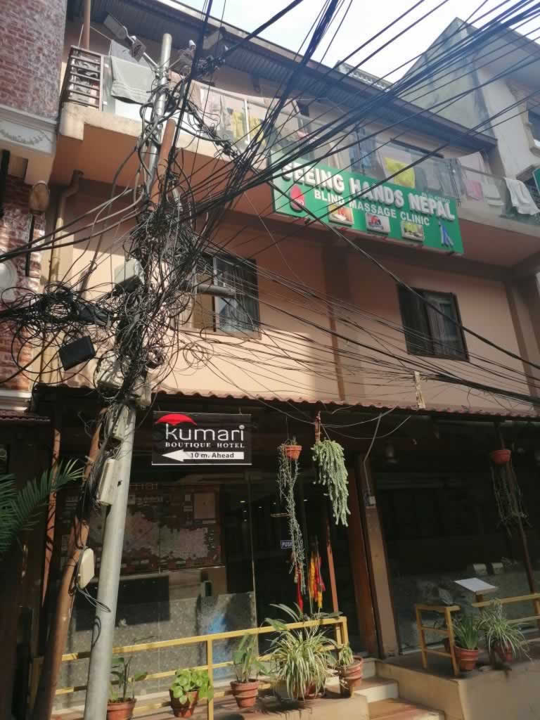
Untangle this, please! Or get a massage at Seeing Hands
Getting to Thamel, though, was another hurdle none of us had seen coming. Driving in Kathmandu is such a hot topic, that it also deserves its own article.
It took about two hours to get to the hotel, only to find out that they had no availability for that night. We spent our first night in Kathmandu in a basic hotel room with the smelliest bathroom on Earth. Even so, much to our surprise, Corina and I slept for 14 hours in a row.
Takeaways:
- Apply for your Nepal visa online here, and have the successful application screen saved in your phone (or print it out). The online visa application will rest in their system for 15 days.
- Book a seat with extra leg room, as that can make a HUGE difference (the guys in front of us had slept all night with their legs resting on the wall, while we couldn’t even recline our seats)
- While on the plane, go to the loo for one last time just before the landing starts
- Don’t start your hike the very first day after your arrival – spend at least two nights in Kathmandu (you may want to shop for gear, anyway)
Day 2: Kathmandu
We spent the morning moving our stuff to Kantipur Temple House, a vintage-style, comfy hotel in Thamel. We liked it so much that we booked it for our return from the mountain, as well.
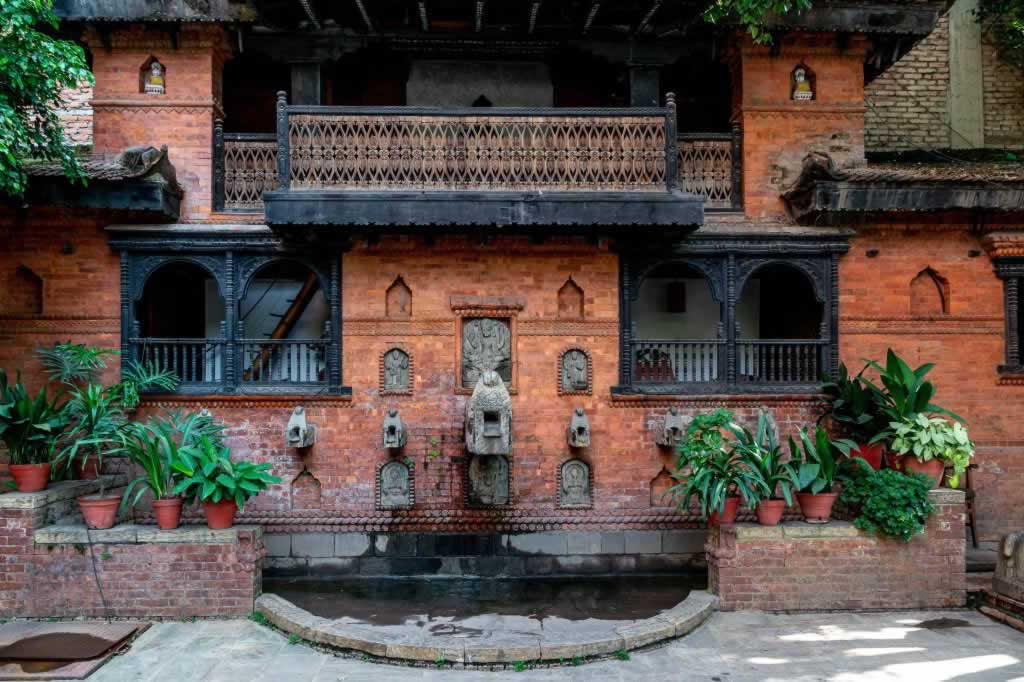
Kantipur Temple House Hotel in Thamel, Kathmandu – traditional, charming, clean and welcoming
Kathmandu is a crazy mix of cars, trucks, bikes, vans, walkers and rickshaws, with no sidewalks and barely any traffic lights. I’ll share my survival tips in a future article.
I bought some nice trekking poles and a shirt. As we had already decided to get a porter, we also bought a large duffel bag to stuff it with items we weren’t supposed to need on the trek. If you want to know more about the things to buy for your EBC trek, check out my Everest Base Camp Trek packing list.
We met Kedar and the Actual Adventure team, and we decided to hire not only a porter but also a guide. They were going to wait for us in Lukla.
Day 3: Kathmandu to Lukla to Phakding
Our plan was to get to the airport as early as possible, in order to ensure we board on the first flight of the day. I made sure my GoPro, my photo camera and my phone were all fully charged, so that I can document the scariest landing worldwide (the Tenzig Hillary Airport in Lukla is renowned for its short and steep landing).
The Kathmandu domestic airport was chocked full of people willing to fly to Lukla. All those who weren’t able to fly the day before because of bad weather conditions were now in the airport, hoping to take off as soon as possible.
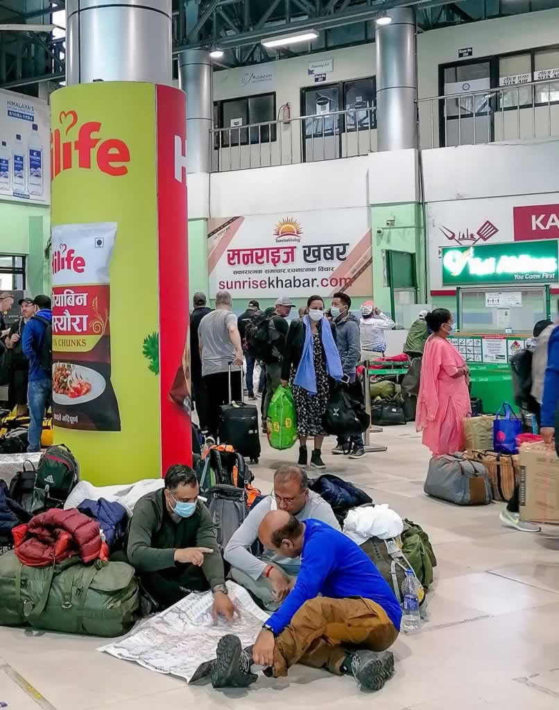
In the domestic airport of Kathmandu travelers plan their treks while hoping their flight to Lukla eventually takes off
Our determination to start the trek that very day set us back $200 US each (in addition to the $320 US we had already paid for the Kathmandu-Lukla-Kathmandu flights). In return, we got helicoptered into Lukla, in a five-seat helicopter, together with another guy who was traveling solo.
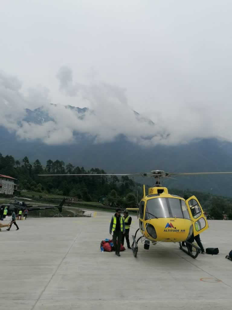
Everest, here we come!
We met Santa, the guide, and our porter in Lukla, we had lunch and we started our trek to Phakding.
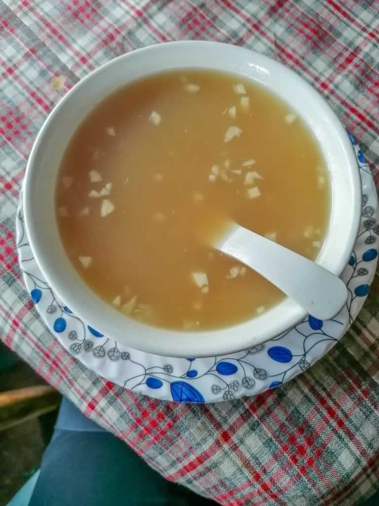
Garlic soup is a staple on the EBC Trek – apparently garlic helps your body acclimatize at high altitude
Facts:
- Distance Lukla (2,860 meters / 9383 ft) – Phakding (2,650 meters / 8,694 ft): ~ 7.8 km / 4.8 miles
- Elevation gain: -210 m / -689 ft
- Trekking time: ~ 3.5 – 4 hours
- Breaks: one short tea and coffee break, in one of the villages along the trail
- Oxygen at Lukla: 73% of sea level
- Oxygen at Phakding: 74% of sea level
Some people prefer to keep going for 2-3 more hours and stop in Monjo (2850 m / 9350 ft) for this first night on the trek.
Day 4: Phakding to Namche Bazaar
This is one of the longest days on the EBC trek. Starting early is best. We woke up by 6:30 am, and we managed to get moving by 7:30.
At home, I rarely eat before 11:30 or even 12. If you’re like me, you’ll need to adjust to the new reality of having breakfast at 7:30 or even earlier. You’ll walk for several hours before you get a chance to stop for lunch. This is difficult to do on an empty stomach. My favorite breakfasts on this trek were eggs. They fill you nicely and they provide you with enough energy to keep you going for hours.
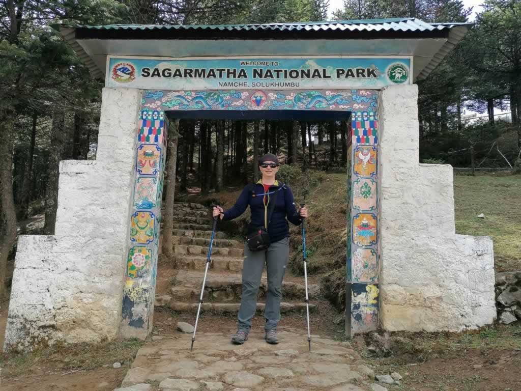
We stopped for lunch by 12-12:30, just after we passed the Sagarmatha National Park checkpoint in Monjo. If you trek without a guide, make sure you keep your trekking permits for the entire duration of your trip, because you’ll need to show them more than once along the way.
The last two hours of this day are unbelievably hard. You’ll climb thousands of stairs, again and again. Every turn you take reveals even more stairs.
This sustained and seemingly endless ascent will take you to Namche Bazar, a relatively large settlement sitting at 3,400m above sea level. This is the first acclimatization spot on Everest Base Camp Trek and the best place to shop for gear and to get some cash.
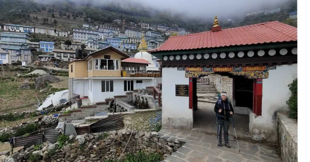
I had been looking forward to this moment for hours
Facts:
- Distance Phakding (2,650 meters / 8,694 ft) – Namche Bazaar (3,440 meters / 11,290 ft): 7.4 km / 5 miles
- Elevation gain: 790 m / 2,596 ft
- Trekking time: ~ 8.5 – 9 hours
- Breaks: lunch break, about 5 hours into the trek
- Oxygen at Phakding: 74% of sea level
- Oxygen at Namche Bazaar: 67% of sea level
Day 5: Namche Bazaar Acclimatization Day
Acclimatization is the best remedy against acute mountain sickness (AMS). Altitude sickness can strike when you climb too quickly and it may include a wide array of symptoms such as headache, dizziness, nausea, shortness of breath, and loss of appetite. As your body adjusts to this change in altitude, symptoms fade away, usually within one day.
One of the rules that help prevent AMS is to climb high and sleep low, hence the need for spending two acclimatization days during the EBC trek.
The other rule states that the daily elevation gain shouldn’t exceed 400m (1,300ft), but that’s not always possible, as you’re going to see here, below).
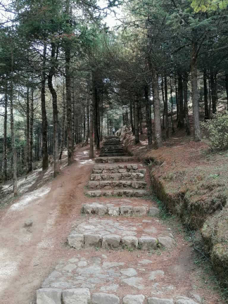
Facts:
- Distance Namche Bazaar (3,440 meters / 11,290 ft) – Everest View Point (National Park Museum) – Hotel Everest View (3,880m / 12,730 ft) – Namche Bazaar: 5.5 km / 3.4 miles (round trip)
- Elevation gain: 440 m / 1,440 ft (followed by the descent back to Namche Bazar)
- Trekking time: ~ 2-3 hours uphill + 1-2 hours downhill (you can take your time and enjoy the views)
- Breaks: Everest View Point National Park Museum visit, coffee break at Hotel Everest View
At Hotel Everest View you can see the Everest for the first time on the trek. This depends on the clouds, though.
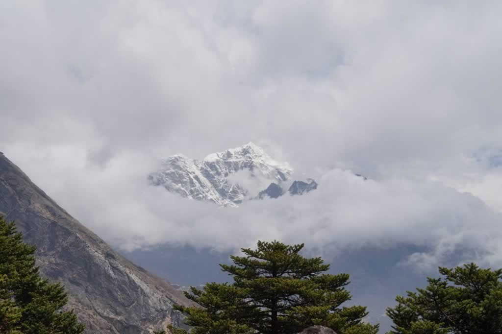
That’s Mount Everest between the clouds
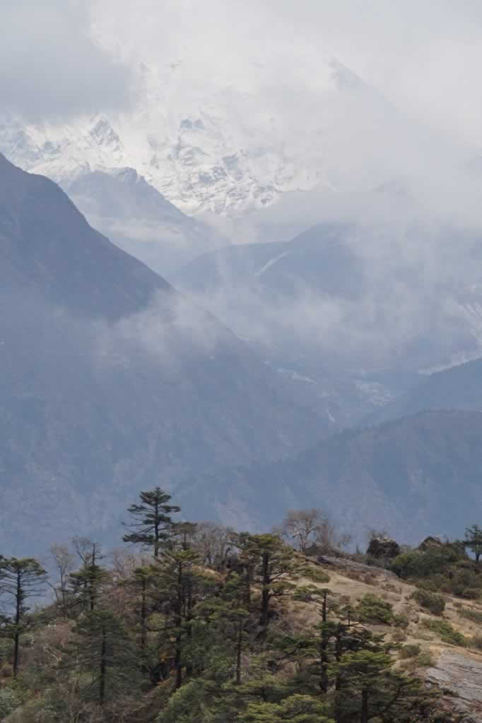
Everest was shy that morning; that’s all it allowed us to view
Day 6: Namche Bazaar to Tengboche (Tyangboche)
This is another long day of trekking. It is also one of the most beautiful, as the path passes through a rhododendron forest. The pink rhododendron is the national flower of Nepal. It blossoms in April. Even though many of those flowers were already gone, we still enjoyed an amazing scenery made from tangled branches and pink petals surrounded by an aura of fog.
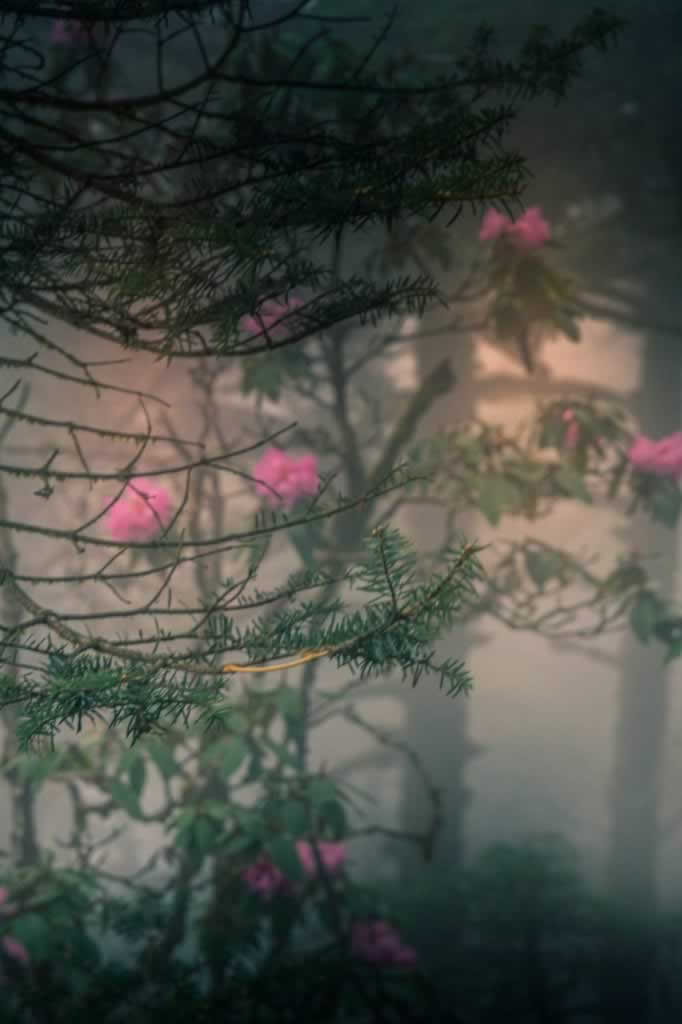
The Enchanted Forest between Namche Bazaar and Tengboche is one of my top favorite spots on the EBC trek
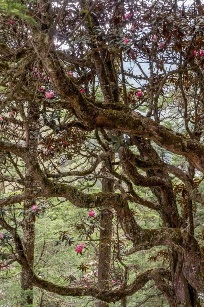
We started at 8am and we reached Tengboche by 4pm, on a foggy and humid weather that made breathing even harder than it already was.
As far as I remember, there are only two lodges in Tengboche. The rooms and the restrooms are rather basic (but this doesn’t come as a surprise). There’s no internet connection. In fact, there’s no village at all in Tengboche. The only buildings are the two lodges and the monastery (which is big and beautiful).
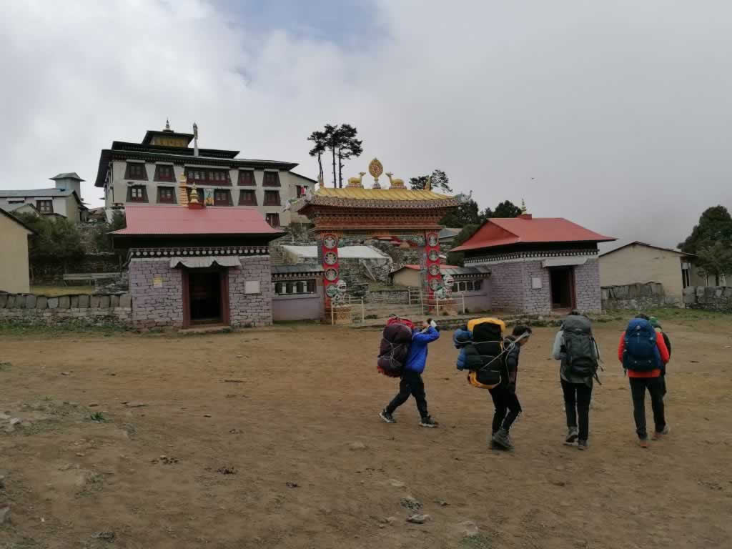
Tengboche Monastery
Facts:
- Distance Namche Bazaar (3,440 meters / 11,290 ft) – Tengboche (3,860m / 12,664 ft): 9.6 km / 6 miles
- Elevation gain: 420 m / 1,380 ft
- Trekking time: ~ 8 hours
- Breaks: One lunch break
Day 7: Tengboche to Dingboche
The Tengboche night had been one of the most difficult ones. Even though the temperature in the room didn’t get below the freezing point, the humidity and the lack of oxygen took a heavy toll on my night rest.
Fortunately, this hiking day was easier than the previous ones. We woke up at 6:30 (as usual) and set sail for adventure by 8am.
One hour and a half into the trek, we reached Pangboche, the next village on the EBC trail. We stopped for a tea and a snack at Everest Fast Food Cafe, at 3,985m altitude. I had plenty of ginger tea and a garlic soup. I was already looking forward to getting to Dingboche, where we would spend our second acclimatization day.
How I loved and cherished those acclimatization days, you can’t even imagine!
No more rushing in the morning to pack your bags, no more heavy backpack to carry, and no more haste on the trail! Hiking lightweight provides you with plenty of photo opportunities, breathing is easier, and there’s enough time to admire the scenic views of those gorgeous mountains.
We arrived to Dingboche mid-afternoon, tired but happy to see that the village was more than a bunch of lodges and a herd of goats.
Accommodation price: 500 NPR/room, fixed for all tea houses in the village.
Facts:
- Distance Tengboche (3,860m / 12,664 ft) – Dingboche (4,410m / 14,470 ft): ~ 10.5 km / 6.5 miles
- Elevation gain: 420 m / 1,380 ft
- Trekking time: ~ 6 hours
- Breaks: One lunch break
Day 8: Dingboche Acclimatization Day
During the Dingboche acclimatization day we climbed a nearby hill. We didn’t reach the top, but we got high enough to take some stunning photos of the valley and of the faraway mountains.
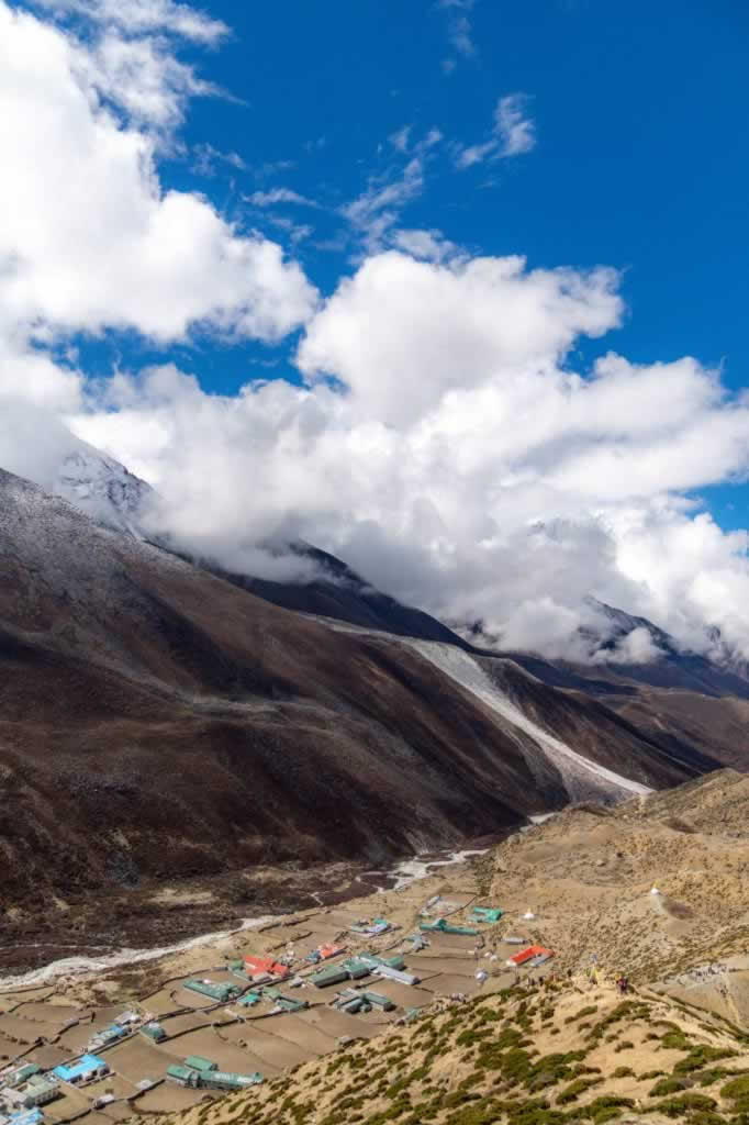
This is Dingboche as we’ve seen it from the top of the hill where we did our acclimatization climb that day
We then got back to the village on a sunny weather that brought smiles on our faces and an awesome opportunity to take a hot shower and to dry our hair in the sun, on the deck of our lodge.
We highly appreciated the time spent in the internet cafe in Dingboche, a welcoming venue choked-full of hikers and buzzing with life.
Day 9: Dingboche to Lobuche
Even though the trek from Dingboche to Lobuche is shorter than many of the previous ones, it isn’t easier. The rocky terrain and the lack of oxygen will slow you down big time. Every step you take is a battle. At such altitudes no trees can survive. You’ll find the odd bush or shrub here and there, but more often than not you’ll only see boulders, dust and yak shelters made of stones, on a backdrop of huge mountains covered in snow and ice.
In Lobuche, we spent the night at Alpine Home & Restaurant, a lodge like any other, freezing cold and basic, but clean, welcoming, and run by lovely people.
Accommodation price: 500 NPR/room, fixed for all tea houses in the village.
Facts:
- Distance Dingboche (4,410m / 14,470 ft) – Lobuche (4,940m / 16,200 ft): ~ 8 km / 5 miles
- Elevation gain: 530 m / 1,740 ft
- Trekking time: ~ 5 hours
- Breaks: I don’t remember having any break, as there are no villages between Dinboche and Lobuche.
Day 10: Lobuche to Gorakshep to Everest Base Camp and Back to Gorakshep
This was the big day, the one when we reached the Everest Base Camp. It was a very long hiking day, so we left Lobuche before 7am to get to Gorakshep by 11am.
We checked in, had lunch, left our big backpacks and headed to the Everest Base Camp to reach it by 2:30pm.
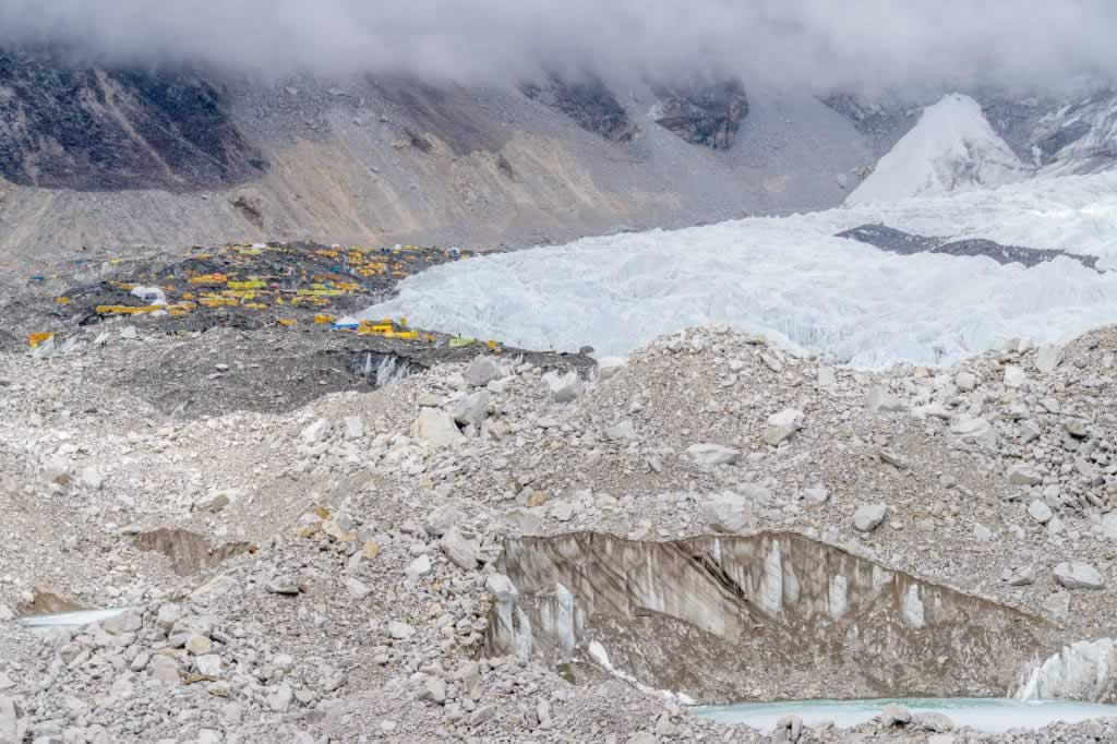
The tents at Everest Base Camp on the glacier – we were at about 45 minutes from reaching the EBC
The site of the EBC was busy as hell, with lots of big groups waiting to take their success photos with the big boulder showcasing the altitude. Expect to spend at least 30 minutes there.
In Gorakshep, we stayed at Snowland Highest Inn. I guess that’s as good as any other choice, even though it’s been the least clean of all lodges on the EBC trek.
Nevertheless, it’s worth mentioning that lodging conditions in Gorak Shep have improved a lot over the past decade. I read articles dating from 2015 or even earlier, where the authors described toilets from hell, foul odors and piles of feces. That’s not the situation anymore.
Facts:
- Distance Lobuche (4,940m / 16,200 ft) – Gorakshep (5,180m / 17,000 ft): ~ 4.5 km / 2.8 miles
- Elevation gain: 240 m / 800 ft
- Trekking time: ~ 4 hours
- Distance Gorakshep (5,180m / 17,000 ft) – Everest South Base Camp (5,364m / 17,598 ft) – Gorakshep: ~ 3.5 km x 2 = 7km / 5 miles
- Elevation gain: 184 m / 600 ft
- Trekking time: ~ 3-4 hours
- EBC Celebration & Photos Break: 30 min – 1 hour
Day 11: Gorakshep to Kalapatthar to Lobuche
Kalapatthar is a hill that has become extremely popular among EBC trekkers, due to the impressive views of the Everest it provides. The ascent starts in Gorak Shep and it takes between 1.5 and 2 hours.
The return hike takes probably 30 minutes to one hour. I say probably because I couldn’t be bothered to wake up in the middle of the night to climb Kala Patthar in the dark, only to hope for clear skies once I get to the top. Two of our friends decided to climb Kalapatthar, together withe our guide, Santa.
Once our friends returned from Kalapathar, we had breakfast and we started the trek to Lobuche. One of us went to spend one night in the Everest Base Camp (yes, this is possible, but only with prior booking), then join us in Lobuche to continue our trek.
Day 12: Lobuche to Dzongla
From Lobuche, you take the same path to Dingboche up to a road fork where you need to keep right to get to Dzongla (or Zonglha, Zongla, Dhzonglha). The left fork leads to Dingboche.
The trail is nice, well defined, dusty and smooth. I found it very annoying that the trail has so many ups and downs, only to end up lower than it starts.
We haven’t met a soul during the entire three hours of our trek. Just like Lobuche the other day, Dzongla looked deserted, probably because we were at the end of the trekking season, on the verge of the monsoon period. Even the previous night in Lobuche we were the only guests at our lodge.
I enjoyed sitting around the yak dung-powered stove with porters, guides and lodge staff, telling jokes and stories, smiling and filling myself with ginger tea.
In Dzongla, we stayed at Maison Sherpa, which I utterly fell in love with at first sight. It is the most beautiful lodge, run by a Sherpa family, welcoming and warm, with plenty of adornments (real eye candies after the very basic lodges in Gorakshep and Lobuche).
Facts:
- Distance Lobuche (4,940m / 16,200 ft) – Dzongla (4,830m / 15,846 ft): ~ 6.5 km / 4 miles
- Elevation gain: – 110 m / – 364 ft
- Trekking time: ~ 3 hours
Day 13: Dzongla to Cho La Pass to Dragnag (Dragnak, Thagnak, Thragnak)
Crossing the ChoLa Pass requires a very early start, because of the unpredictable weather conditions. Most afternoons bring clouds and strong winds, so it’s best to reach the highest point of the pass before noon.
We managed to get there by 11am, about 4-5 hours into the trek. The first part of the trail is rather flat. The path that crosses the Cho La glacier is also flat for its most part. That’s where microspikes can help you a lot. We bought ours in Namche Bazaar for 2,000 NPR (about $16 US).
On top of the pass, the weather was already cloudy, cold and humid, but not windy. We ate our sandwiches, took some photos with the prayer flags marking the 5420m altitude point, and 30 minutes later we were ready to start the descent through Cho La Pass.
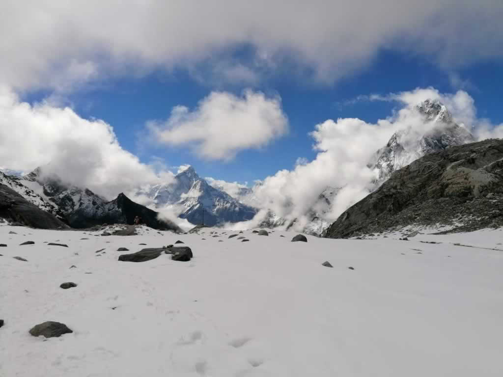
Cho La Pass – The Crossing of the Glacier
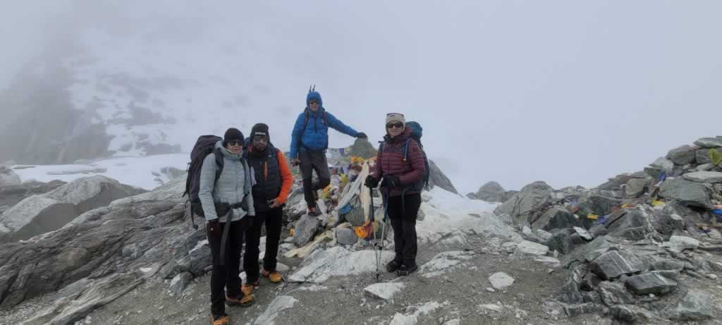
The prayer flags at the highest point of Cho La Pass (5420m)
The descent is steep, strenuous and long, but it doesn’t require any technical skills. There’s a metal line alongside the path to for the most part of the trail.
Just go slowly, pay attention to your feet and you’re going to be just fine. Expect about 45 minutes of nothing but focusing on your shoes.
Depending on the amount of ice on the path, you may or may not need the microspikes. I wore mine for a while, but I took them off at some point, because they started to annoy me as I stepped on bare rocks.
Once you’re done with this descent, the trail goes uphill again, and then downhill, and then uphill, and downhill for the last time.
This last part of the trail goes through a narrow, rocky valley, between a river and the mountainside. It feels boring, tiresome and endless. It almost made me cry.
Dragnag (or Thragnak), perhaps the most looked forward to village on this trek, is nothing but a bunch of houses. Some people only stop here for lunch on their way to Gokyo.
In my opinion, the crossing of the Cho La Pass is rough enough to call it a day and spend the night in Dragnag.
Facts:
- Distance Dzongla (4,830m / 15,846 ft) – Dragnag (4,700m / 15,420 ft): ~ 8 km / 5 miles
- Maximum Elevation Point (Cho La): 5,420m / 17,782 ft
- Trekking time: ~ 8.5 – 9 hours
Day 14: Dragnag to Gokyo Lake
“Just when I thought I was out, they pull me back in!”
Do you remember Al Pacino’s line in The Godfather, when he was just going to quit the mafia? That could summarize my feelings when I saw the entrance to Ngozumpa, the last glacier we had to cross on our Everest Base Camp Trek.
After shedding a tear or two on my way to Dragnag the previous day, I would have thought rough days were over.
Little did I know that this day was going to start with a crazy descent through boulders and dust, a stunt that ended up in laughter, as I refused to stand on those rocks, much to the despair of Santa, our guide. He neither understood nor approved of my intention to crawl on my gluteus maximus through dust and stones. Believe me, where everything fails, crawling works. There’s even a video that proves it!

I would not stand for anything in this world! That’s a trail for goats 🙂
This is how the crossing of Ngozumpa glacier begins. Once you pass the edge of the glacier, you’ll be walking on an almost flat trail made of boulders of all shapes and sizes.
You won’t need your microspikes anymore, because the terrain is rocky, with no portions of exposed ice on the trail. It is, however, strenuous. Out of all boulders that make the trail, some move more than others when you step on them. Expect an exhausting hurdles race that calls for focus and endurance.
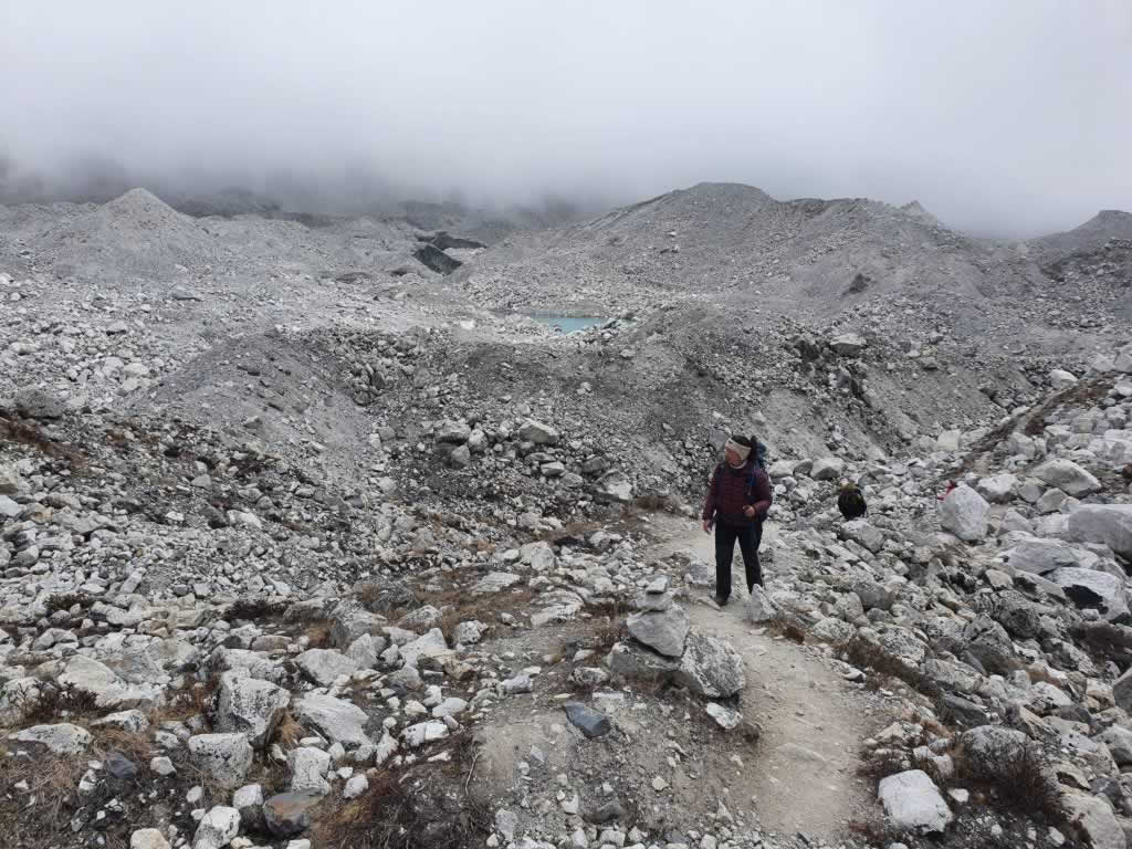
The scenery goes like this for a long time. Glaciers aren’t what I’ve imagined.
The scenery is impressive. The massive boulders, the green ice, the small lakes and the light gray pebbles contrast to each other in a striking manner.
You won’t feel like stopping here for too long; the sounds of falling rocks and cracking ice will make you push to get off the glacier as soon as possible.
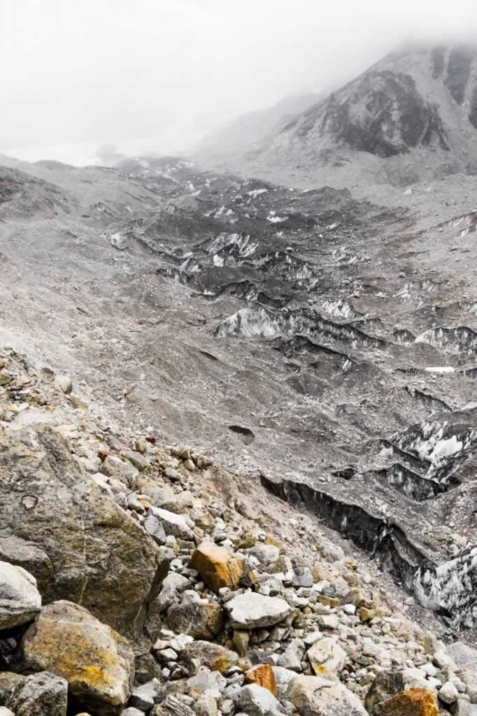
Ngozumpa Glacier Upclose – Boulders and dirt protect the beautiful ice deep beneath
Climbing your way off the Ngozumpa glacier and back to the good old dirt trail is another exhausting but perfectly doable stint. You’ll climb a dusty, narrow path along the mountainside. There’s a line to use for its most tricky part, but again, you’ll see nothing but your shoes for a good half hour or so.
Once you’re done with the edge of the glacier, a smooth and nice trail will lead you straight into Gokyo. The scenery around the lake is so beautiful that it makes all of these efforts worthwhile.
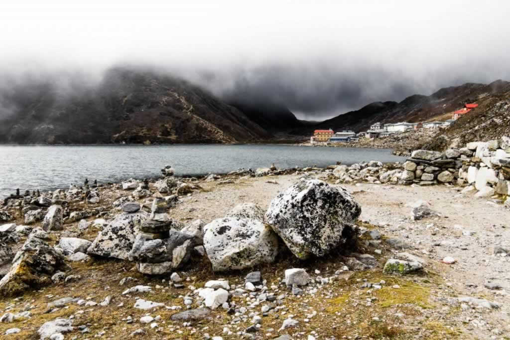
Gokyo Lake and Village
Facts:
- Distance Dragnag (4,700m / 15,420 ft) – Gokyo Lake & Village (4,790m / 15,715 ft): ~ 6.2 km / 3.85 miles
- Trekking time: I don’t really remember, but I think we trekked for about 6-7 hours
Day 15: Gokyo Lake to Gokyo Ri to Dole
Just like Kalapatthar, Gokyo Ri is a hill that offers magnificent views of the mountains, provided that you’re willing to put in the two hours of effort to climb it. I wasn’t. I got some lovely photos of Gokyo Lake instead, while waiting for my more adventurous friends to descend. Their photos were very beautiful, though, so I felt a bit sorry for not waking up at 3am to climb Gokyo Ri.
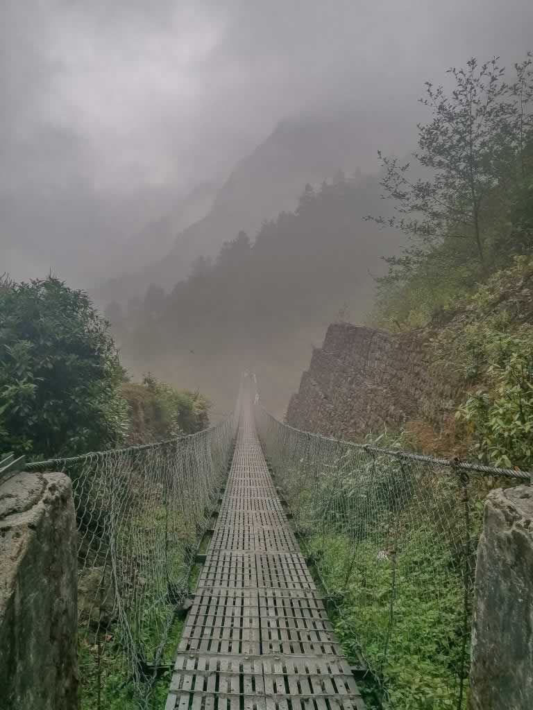
From Gokyo to Dole, you’ll be on a descending trail that goes along the Dudh Khosi River. It is a very beautiful trek, with lots of photo opportunities such as waterfalls and bridges. The monsoon season had already started, so there was plenty of water flowing down the mountains into the river.
Facts:
- Distance Gokyo (4,790m / 15,715 ft) – Dole (4,038m / 13,248 ft): ~ 12 km / 7.3 miles
- Elevation Gain: – 752m / – 2,467 ft
- Lunch Break: Machhermo (4,470m / 14,665 ft)
- Trekking time: ~ 5 hours
Day 16: Dole to Namche Bazaar
This has been a longer trek, but getting to Namche Bazaar sooner is better than later. Besides, descending is much easier than ascending, so there’s no point in procrastinating along the trail.
Facts:
- Distance Dole (4,038m / 13,248 ft) – Namche Bazaar (3,440 meters / 11,290 ft): ~ 11.5 km / 7.2 miles
- Elevation Gain: – 598m / – 1,958 ft
- Trekking time: ~ 6 hours
Day 17: Namche Bazaar to Lukla
The last day of the Everest Base Camp Trek is a long one. For us, it was also a rainy one, at least for about hours or so. That was the only time I got to wear my rainproof pants which I carried in my backpack for the entire trek.
Fortunately, all of our trekking days unfolded as scheduled, so we arrived back to Lukla two days before our flight date.
Facts:
- Namche Bazaar (3,440 meters / 11,290 ft) – Lukla (2,860 meters / 9383 ft) distance: ~ 13.5 km / 8.4 miles
- Elevation Gain: who cares about this anymore?
- Trekking time: ~ 8 hours
Day 18: Lukla – We couldn’t change the date of our flight out
As there are no evening flights from Lukla, you must spend at least one night in the town. We had to spend two, as we couldn’t switch our tickets.
We spent this full day in Lukla doing nothing, drinking coffee, eating, drinking beer, and talking about nothing and everything.
Day 19: Lukla to Kathmandu
This time we were able to board our plane as scheduled. The flight was cool, but the taking off isn’t special, so we didn’t experience the thrills of the most dangerous landing in the world.
The first thing we did in Kathmandu was to buy some clothes. Or to shower. I don’t remember the order, but both things were extremely pleasurable after not washing and not changing clothes for so many days.
Day 20: Kathmandu
We used this full day to wander the streets of Thamel. We visited some temples and an art workshop, we ate street food, we took lots of photos and we bought fresh fish to have it cooked in a restaurant near our hotel.
Day 21: Flight back home
Departing Nepal is much easier than getting in. This time we had a day flight. Within three movies, we were already in Istanbul, where we had a few hours to wait for our connecting flight to Bucharest.
The second flight was also smooth. By the end of our journey, though, we had another surprise that made us spend a few hours in the airport: none of our bags had made it to Bucharest. Apparently, they never left the Kathmandu airport.
We were going to receive them one week later. Our friend who had to return to his home in the US got his bags after more than one month.
If you haven’t find your answers in this article, check out my EBC Trek FAQ post, as it contains more information and more photos from the amazing Nepal.
- Ramla Beach Gozo, Maybe the Best in Malta - April 9, 2024
- Where To Go on Honeymoon: List of the Most Interesting Countries - April 9, 2024
- A Guide to Nepal Treks from India - April 5, 2024

